February 2, 2026 | 07:58 am
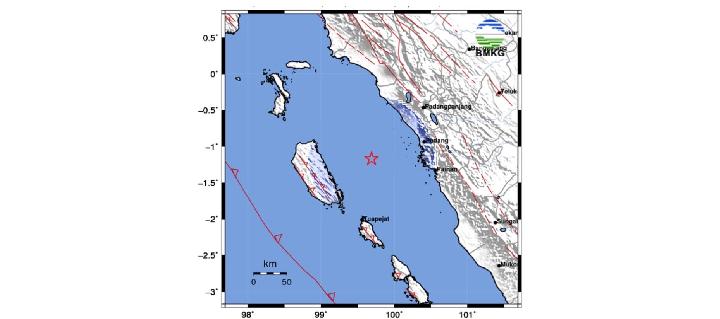
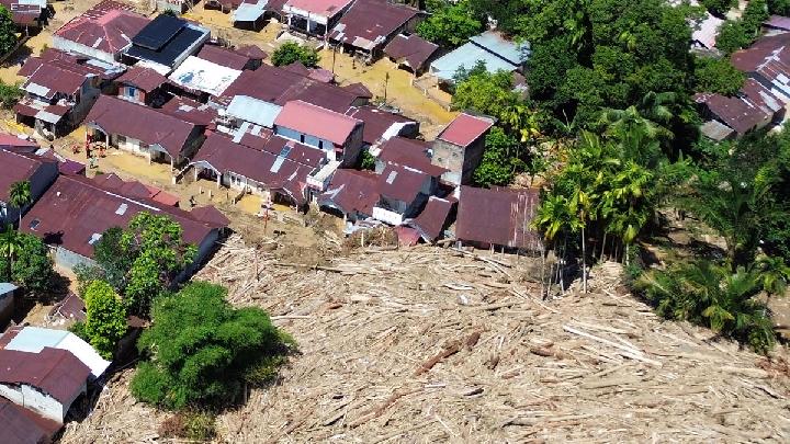
TEMPO.CO, Jakarta - The Indonesian Meteorology, Climatology, and Geophysics Agency (BMKG) reported a tectonic earthquake with a magnitude of 4.4 struck Siberut Island, Mentawai Islands Regency, West Sumatra, on Monday morning, February 2, 2026. The BMKG confirmed that the earthquake did not have the potential to cause a tsunami.
Suaidi Ahadi, Head of the Padang Panjang Geophysical Station, said the earthquake occurred at 5:20:42 a.m. Western Indonesian Time (WIB), with the epicenter at sea approximately 77 kilometers southwest of Pariaman, West Sumatra. The quake occurred at a depth of 23 kilometers.
"Considering the location and depth of the epicenter, the earthquake was a shallow earthquake due to activity on the Mentawai Fault," Suaidi said in a written statement on Monday.
Suaidi said the tremors were felt in several areas in West Sumatra with an intensity of II to III MMI. "Based on the estimated tremor map, the earthquake was felt in Padang City, Pariaman City, Lubuk Basung, and the Mentawai Islands at a magnitude of II-III MMI. This means that the tremors were felt by many people and felt clearly in homes, as if a truck were passing by, and light hanging objects were swaying," he said.
As of 5:45 a.m. WIB, the BMKG had not recorded any aftershocks or reports of damage. "BMKG monitoring results as of 5:45:42 a.m. WIB have not shown any aftershock activity," he said.
"We have also not received any reports of damage caused by the earthquake," Suaidi said.
Read: BMKG Records 97 Earthquakes in West Java During January
Click here to get the latest news updates from Tempo on Google News
BMKG Records 97 Earthquakes in West Java During January
3 jam lalu

The Indonesian Meteorology, Climatology, and Geophysics Agency (BMKG) recorded 97 earthquakes in West Java during January 2026.
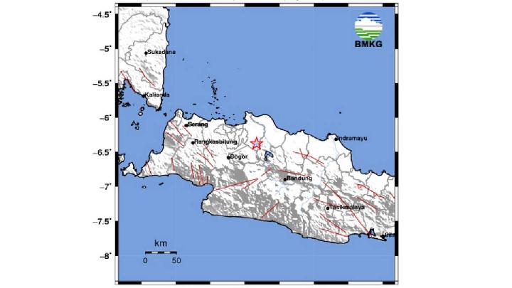
BMKG Records Earthquake in Bandung This Morning
3 hari lalu

Here are the data and explanations from BMKG regarding the earthquake.
Mount Merapi Ejects Pyroclastic Flow Hours After Earthquakes in Yogyakarta
5 hari lalu

Mount Merapi on the border of Yogyakarta and Magelang Regency emitted pyroclastic flows at 04:13 p.m. local time on Tuesday, January 27, 2026.
11 Trains Temporarily Halted After Earthquake in Pacitan, East Java
5 hari lalu
Eleven train journeys passing through the PT KAI Daerah Operasi 7 Madiun area were stopped due to an extraordinary earthquake.
Panic in Yogyakarta as M4.4 Earthquake Hits Bantul
5 hari lalu
A shallow magnitude 4.4 earthquake struck Bantul, Yogyakarta, on January 27, 2026.
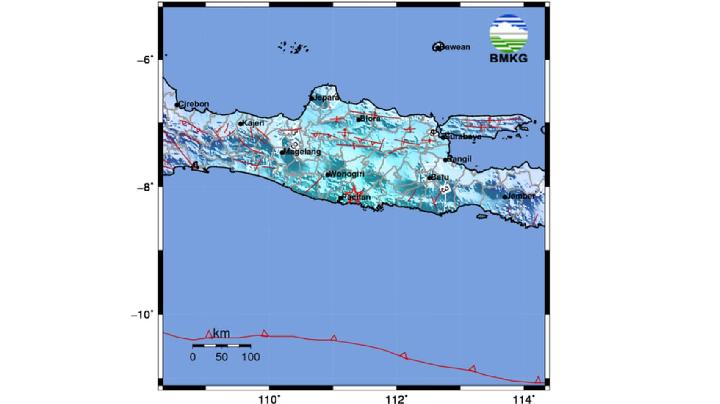
BMKG: M5.7 Earthquake Hits Pacitan, Felt Across Java and Bali
5 hari lalu
The Indonesian Meteorology, Climatology, and Geophysics Agency (BMKG) reported a tectonic earthquake struck Pacitan, East Java, on Tuesday, January 27
BMKG Reports Earthquake Data for Bekasi Regency, West Java
6 hari lalu
An earthquake with a magnitude of 2.7 hit Bekasi Regency in West Java and the surrounding area.
Indonesia's Mount Slamet Sees Spike in Volcanic Earthquakes
21 hari lalu

Mount Slamet in Central Java, Indonesia, is reported to be experiencing an increase in magmatic gas activity.
BMKG: Strong 7.1 Earthquake Jolts North Sulawesi, No Tsunami Risk
22 hari lalu

BMKG detected a 7.1 magnitude earthquake in Melonguane, North Talaud Islands, North Sulawesi on Saturday, January 10, 2026 evening.
Geological Agency: Indonesia Saw 41 Destructive Earthquakes in 2025
26 hari lalu
Most of the destructive earthquake events are caused by active faults located on land.