February 5, 2026 | 06:20 am
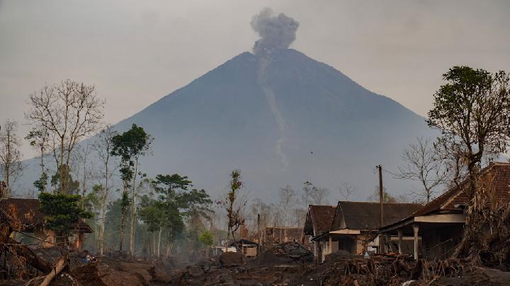
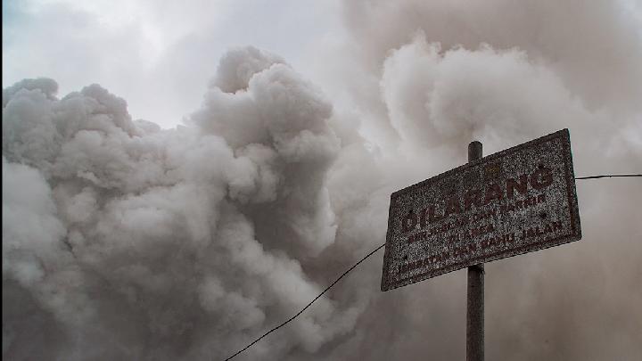
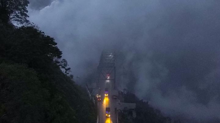
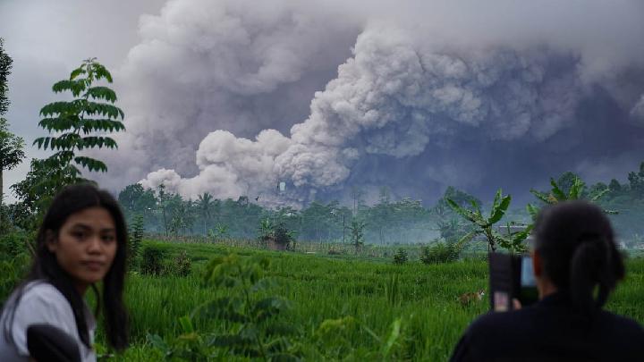
TEMPO.CO, Jakarta - Mount Semeru erupted again early Thursday, February 5, 2026, at 12:13 a.m. Western Indonesian Time (WIB). A white to gray ash column was observed 1 kilometer high above the summit, with moderate intensity extending northward.
The Semeru Volcano Observation Post (PGA) reported that less than an hour later, a follow-up eruption occurred at 12:48 a.m. Western Indonesian Time (WIB), with an ash column reaching approximately 800 meters above the summit.
Meanwhile, based on seismic observations over the past 24 hours, as of early Thursday morning, the Semeru PGA Post on Mount Sawur, Sumber Wuluh Village, Candipuro District, Lumajang Regency, recorded 127 earthquakes.
The earthquakes recorded by the seismogram at the monitoring post under the auspices of the Center for Volcanology, Mitigation, and Geological Hazard Mitigation (PVMBG) included 97 eruption earthquakes with amplitudes of 10-22 mm and durations of 67-152 seconds, one avalanche earthquake with an amplitude of 5 mm and duration of 76 seconds.
Furthermore, there were 21 eruption earthquakes with amplitudes of 3-8 mm and durations of 29-101 seconds, and two harmonics with amplitudes of 2-6 mm and durations of 113-234 seconds. Six distant tectonic earthquakes were recorded with amplitudes of 5-30 mm, S-P of 13-41 seconds, and durations of 33-147 seconds.
Liswanto, an officer at the Semeru Volcanology and Geological Hazard Mitigation Post, stated in his report that Mount Semeru's activity level is at Level III (Alert). "Mount Semeru's activity level remains at Alert," said Liswanto on Thursday, February 5, 2026.
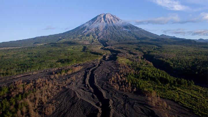
At this level III activity level, the Center for Volcanology and Geological Disaster Mitigation (PVMBG) issued recommendations, including not conducting any activities in the southeastern sector along Besuk Kobokan, within 13 kilometers of the summit (the eruption epicenter).
Beyond this distance, the public should refrain from activities within 500 meters of the riverbank (river boundary) along Besuk Kobokan due to the potential for expansion of pyroclastic flows and lava flows up to 17 kilometers from the summit. Furthermore, the public is asked to refrain from activities within a 5-kilometer radius of the crater/peak of Mount Semeru due to the risk of ejected (incandescent) rocks.
The public is also asked to be aware of the potential for hot clouds and lava flows along the rivers/valleys that originate at the peak of Mount Semeru, especially along Besuk Kobokan, Besuk Bang, Besuk Kembar, and Besuk Sat as well as the potential for lahars in small rivers that are tributaries of Besuk Kobokan.
Read: Mount Semeru Erupts Seven Times From Dawn to Morning
Click here to get the latest news updates from Tempo on Google News
Mount Semeru Erupts Seven Times From Dawn to Morning
21 jam lalu
Mount Semeru's consecutive eruptions were reported from after dawn until this morning, Wednesday, February 4, 2026.
Mount Semeru Emits Hot Clouds for Two Days, Alert Level Remains High
19 hari lalu
During the period of January 7-14, 2026, Mount Semeru's volcanic activity remains high with frequent occurrences of pyroclastic flows.
Volcanic Activity at Indonesia's Mount Semeru Remains High
20 hari lalu
A total of 36 eruption earthquakes were recorded at Mount Semeru from early Thursday to 06:00 AM local time.
Mount Semeru Spews Pyroclastic Flows and Lava Floods
21 hari lalu
Mount Semeru erupted on Wednesday with pyroclastic flows and seismic tremors. Authorities maintain a Level III Alert.
Fact Check: Viral Mount Semeru Eruption Video Was AI-Edited
22 hari lalu
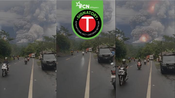
Fact check - The video circulating has been edited using AI from the original footage.
Mount Marapi Erupts in West Sumatra, Spewing Ash 1.2 Km High
51 hari lalu
Mount Marapi in West Sumatra experienced another eruption on Sunday evening, December 14, 2025.
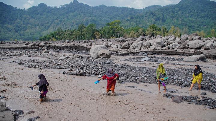
BMKG Warns Prolonged Rain Could Trigger Mount Semeru Mudflows
5 Desember 2025
BMKG has warned of possible mudflows and flash floods on Mount Semeru in East Java after morning rainfall on December 5, 2025.
How Dangerous Are Mount Semeru's Secondary Eruptions?
25 November 2025
Smoke from Indonesia's Mount Semeru's secondary eruptions can be as dense as the primary pyroclastic flows
Understanding Indonesia's Four-Tier Volcanic Activity Levels
22 November 2025
The Geological Agency has escalated Mount Semeru's activity status to Level IV. Here is Indonesia's classification of volcanic activity levels.
How Dangerous Are the Pyroclastic Flow Deposits in Mount Semeru's Valley?
21 November 2025
Indonesia's Geological Agency head warned that Mount Semeru's recent pyroclastic deposits could cause secondary disasters if unmanaged.